

Space Archaeology
Satellite imagery is changing the way we see our past and revolutionizing the study of archaeology as we know it.
The concept of aerial archaeology isn’t a new idea; it actually dates back to before the First World War. What is new, is the use of satellite imagery and it’s become one of the fastest growing tools in the field.

More specifically, it’s the application of multispectral, hyperspectral and panchromatic satellite imaging that has lead to the discovery of thousands of archaeological sites in just a few short years.
SATELLITE IMAGERY: A RETROSPECTIVE
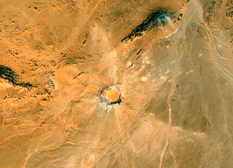
Satellite imagery has come a long way since the US launched the Explorer 6 and took the first photographs of earth in orbit in 1959. Not only are there over a thousand satellites orbiting earth at this very moment, the quality of the data that they are collecting has far surpassed that of their predecessors. To illustrate their capabilities, see the images below:
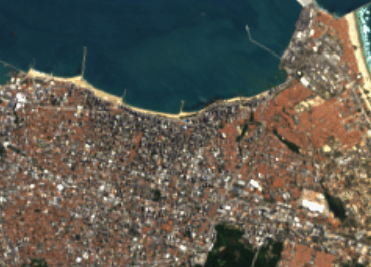
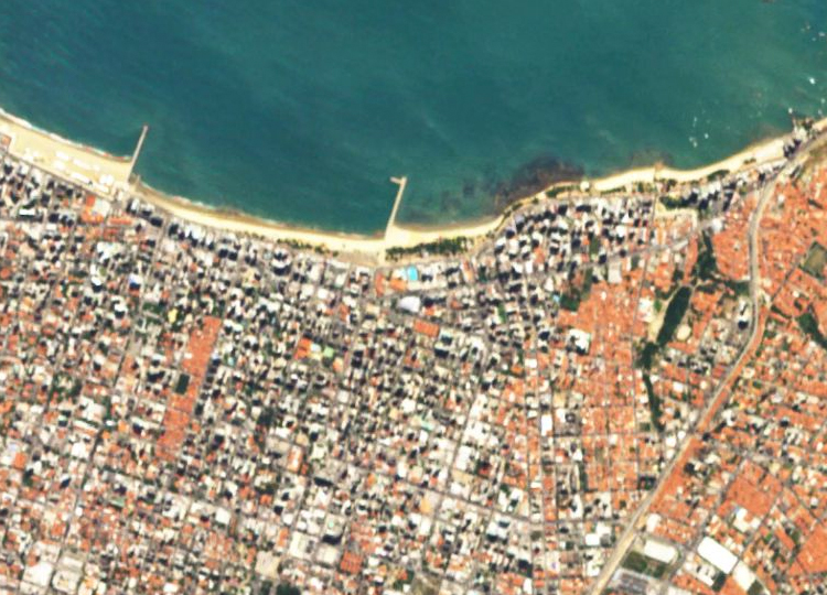
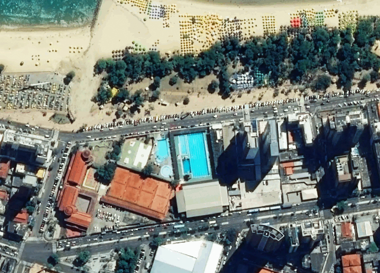
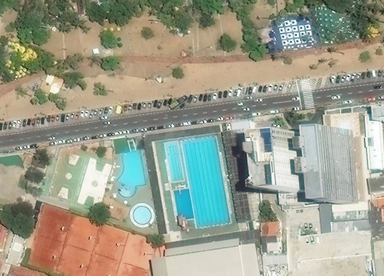
The images above highlight the detail that satellites capture while orbiting miles above the earth, images that are easily available to anyone with tools like Google Earth. This has had a huge impact in the archaeological community, specifically with archaeologists like Scott Madry, who had previously relied primarily on aerial archaeology: “I’ve spent 25 years on and off bouncing around in low-level aircraft, searching old maps, looking at aerial photographs, and I found a handful of new archaeological sites. I found more sites on the first day of sitting down and doing a systematic survey on Google Earth than in those years of using the other techniques.”
MULTISPECTRAL VISION
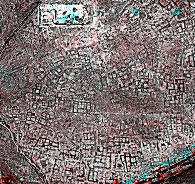
However, the capabilities afforded by tools like Google Earth only scratch the surface of what can be achieved with satellite imaging. Most satellites still have the same limitations as aerial archaeology, namely, they only capture what’s visible to the human eye, otherwise known as ‘true colour composites’. Satellites with multispectral, hyperspectral and panochromatic capabilities can capture imagery with a combination of bands within the electromagnetic spectrum (including near-infrared and ultraviolet light), otherwise known as ‘false colour composites’ and these have proven to be far more useful to archaeologists. This is due to the fact that these images can pick up on aspects like vegetation health, which varies over ancient sites.
Satellites with LIDAR (which stands for Light Detection and Ranging) capabilities can even create 3D, high-resolution images indicating land elevation and even subterranean objects. This is achieved by measuring the time it takes laser pulses projected onto the earth’s surface to bounce back. This data is then compiled and sorted by software and a 3D image is created.
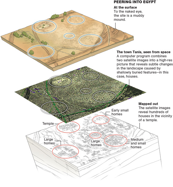
Dr. Sara Parcak of the University of Alabama at Birmingham, a trailblazer in the realm of space archaeology, has used this technology to uncover over a hundred sites in the Egypt’s Delta and Nile valleys. Her most notable discovery was of a thousand tombs within the Egyptian city of Tanis – which most people might remember from this movie.
She estimates that “humans have uncovered fewer than one one-thousandth of one
percent of the archaeological sites along the Nile River delta alone.” That’s a
staggering glimpse of what continues to lie hidden right before our eyes that may only be revealed to us from above. Archaeology hasn’t been this exciting since Indy.
Check out Teledyne Optech‘s wide range of Lidar systems:
http://www.teledyneoptech.com/index.php/products/airborne-survey/lidar-systems/
Further reading on Hyperspectral Imaging:
http://teledynedalsa.com/en/learn/markets-and-applications/aerospace/hyperspectral/
