

Airborne Lidar Bathymetry Data and its Expanding Role in Non-traditional Segments
The correct and accurate processing of Airborne Lidar Bathymetry (ALB) data can reveal various aspects of the real-world environment that are critical to managing our nearshore and coastal areas in a responsible and inclusive way.
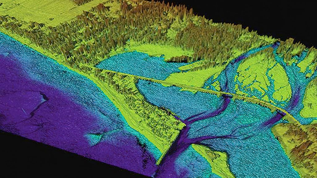
Traditionally, ALB was largely promoted as a technique for measuring the depths of near-shore coastal waters and other shallow water bodies. The sophisticated topo-bathy lidar systems of today can provide full waveform returns from the seabed. That means, just like multibeam backscatter or side scan interferometry from acoustic sensors, one can also generate reflectance imagery from ALB and identify the nature and form of the seabed as it changes. Equipped with high resolution cameras, these systems can provide excellent RGB and sometimes multispectral imagery of the survey area. This is significant because, over and above just looking at the land and water surfaces and obtaining the depths, one can ground truth the generated imagery and create seabed classification maps and other end products that can be used by a multitude of industries and end-users.
Hydrographic survey companies primarily service government charting agencies and large maritime NGOs, bodies that are particularly focussed on nautical charting and related products. The same surveys that provide these agencies with the data for charts can however be leveraged for additional applications by a host of different segments and stakeholders.
Through experience and practice in wider stakeholder outreach, more opportunities are appearing. The market is still relatively young, because many agencies that typically aren’t mapping as their principal activity can still benefit from access to bathy lidar data. Their main responsibility might be coastal zone management or resiliency, or they might be dependent on monitoring and maintaining a healthy environment on which their industry depends, such as mariculture or fish farming. Topical key phrases discussed today include protecting and understanding the environment, change detection, sea level rise, flood inundation modelling — all requiring shallow water data and details on the land-sea interface.
With already available information hiding in plain sight and easily accessible from the service providers within the hydrographic realm, the potential to provide ALB data to a wider user base is exciting and far-reaching.
Applications for ALB data by diverse stakeholder groups
A ‘tree of information’: raw, full-waveform ALB data rising from the roots and through the processing trunk can branch out and be processed into geospatial information to create a variety of end products for a diverse community of end-users.
Land Use/Cadastral
Nearshore and intertidal cadastral; baseline determination
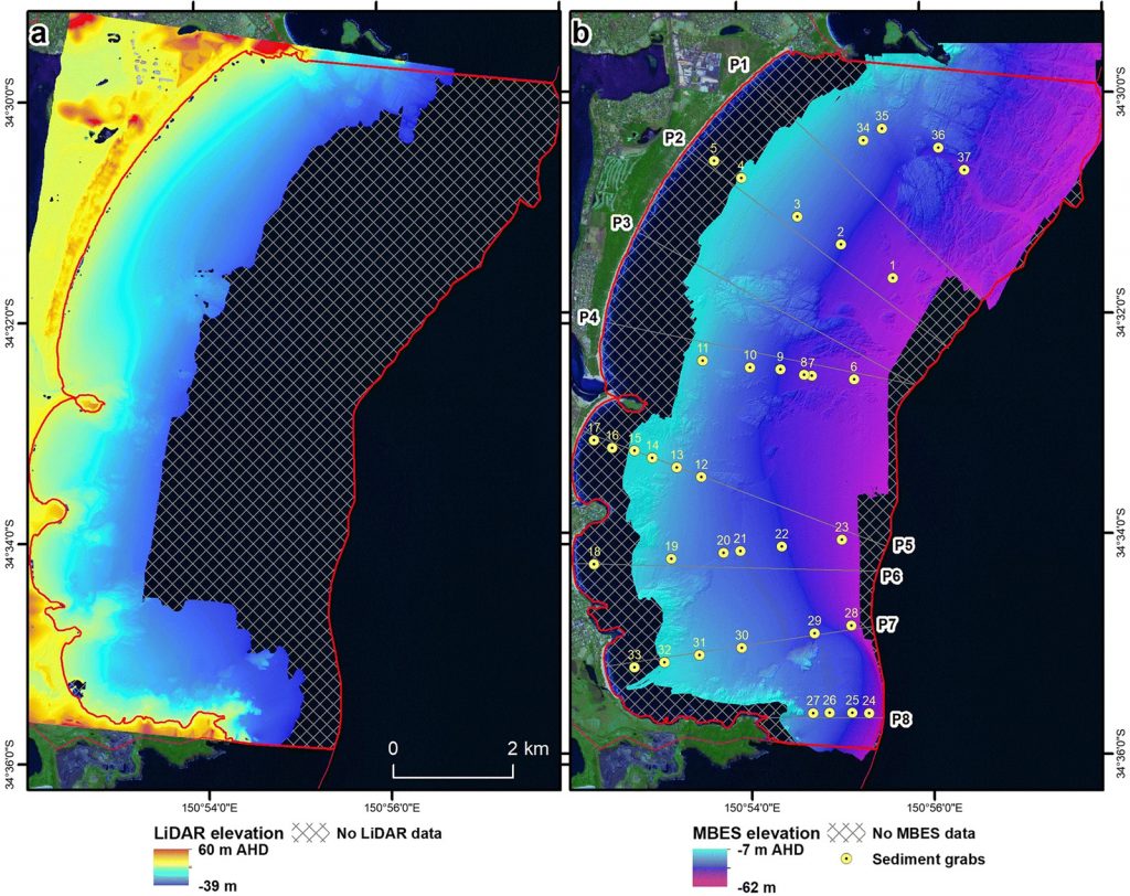
Terrestrial survey data often needs to extend into the inter-tidal zone and low water elevation boundaries to characterize land ownership rights and to develop an accurate national baseline determination, from which all maritime territorial limits are established. ALB provides accurate and the most efficient technology to capture this domain-variable zone.
Tourism
RGB planar and oblique imagery; water clarity/features
During the conduct of many ALB surveys, high-resolution, geo- and ortho-rectified imagery is also collected, providing an excellent visual data source for regional authorities to promote their coastlines and clean environments. Informed planning can also allow the capture of low-altitude, oblique aerial imagery to better support this stakeholder group.
Oil & Gas, Submarine Cables, and Renewable Energy
Pipeline terminations, optimal routing in shallow water, beach terminals, major cable terminations, shallow water drilling activities.
An integrated land-water data capture, where coastal features can be considered more holistically, can serve several industries keen to ensure that their infrastructure creates the least environmental impact as their operations near the coast and move on land.

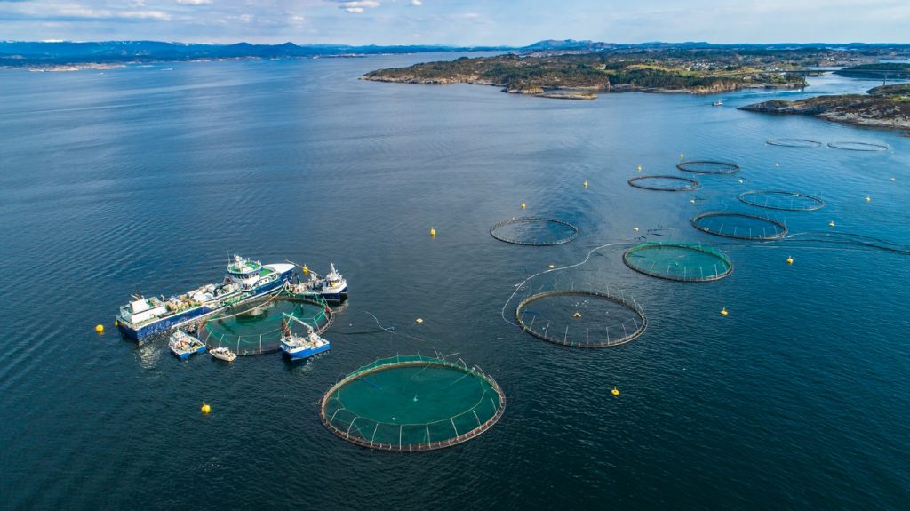
Mariculture; Fishing
Seabed and nearshore characterization, seagrass coverage, shellfish beds, aquaculture, seabed features.
Bottom sediment characterization and the extent of marine flora such as kelp and eelgrass can better inform the mariculture and fishing industries of optimal sites for new developments and serve as a baseline from which environmental impacts of human activities can be determined and mitigated on already established natural ecosystems.
Coastal Defense
Baseline surveys over land-sea interface, change detection.
The rapid coverage obtained by ALB provides a ‘snapshot’ of the nearshore region and subsequent repeat surveys can provide excellent change detection and trending. This in turn can better inform the coastal zone management teams of where and when remedial action is required to prevent erosion and other habitat damage.

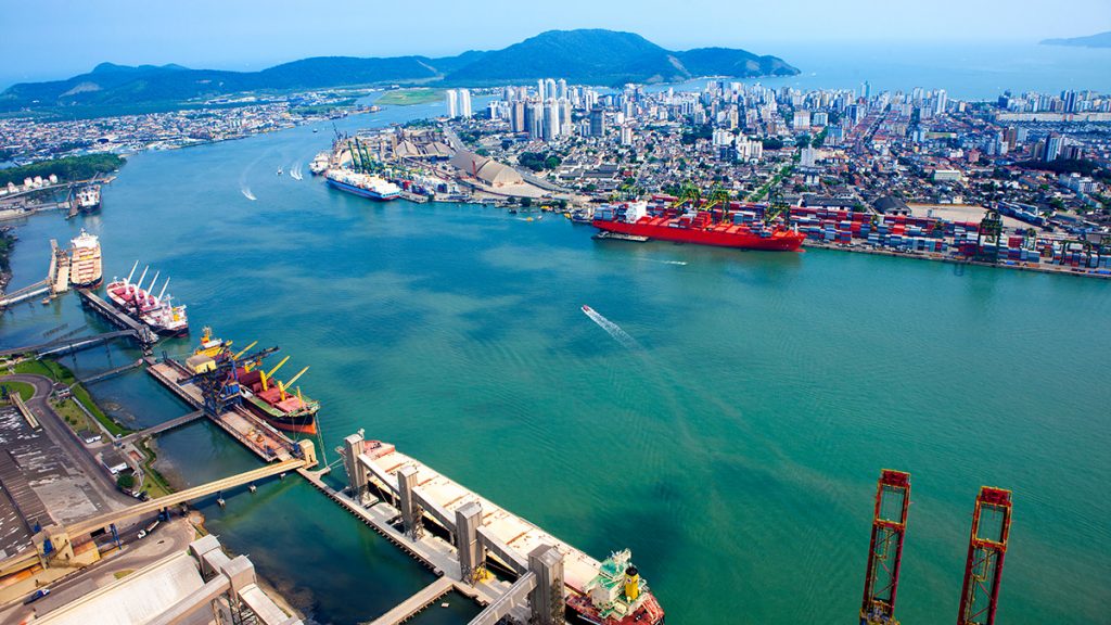
Ports & Navigation
VTS/management, change detection, pre-dredge estimates.
Regular routine re-surveys of the immediate hinterland of ports and other important safety-of-navigation infrastructure can help ensure navigable channels remain well marked and monitored, and that accretion or scouring conditions are carefully assessed. ALB can help complete this picture by providing seamless land-water interface data.
Military Activities
Shallow water ASW, MCM ops, ‘amphibiosity’
ALB has enviable Rapid Environmental Assessment (REA) capability; a facet of data acquisition and assimilation highly prized by military and civil defense agencies alike. This informs the nearshore ‘tactical picture’ for several applications such as shallow water mine warfare and anti-submarine operations, amphibious landing planning and similar activities.

Culture
Historic wrecks and coastal sites.
Many wrecks and important natural and man-made structures and historic sites lie within the shallow coastal region—accurate mapping and monitoring of these sites can aid in their preservation and cataloging.

Conservation
Change detection and mitigation steps.
This sector can benefit from the accurate and high-resolution determination of not only the bathymetry and topography from ALB but also the land and seabed classification obtained from the reflectance imagery and photo imagery from such surveys.

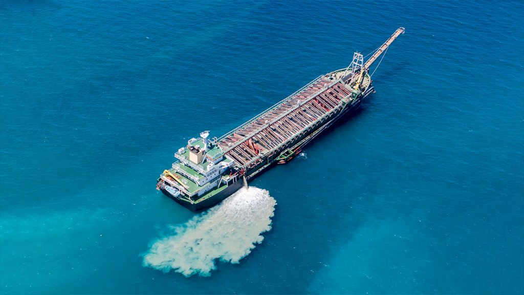
Dredging & Disposal
Sand borrow, sediment loading and transport, stability.
In regions of mobile seabed and particularly where beach tourism is a big economic factor, the regular monitoring of sediment transport and on-land beach erosion help mitigate any negative effects of this process and better determine areas of sand borrow for beach and other coastal renourishment projects such as marshlands etc.
Marine Recreation
Boating, diving areas, non-commercial fishing.
The nearshore bathymetry and habitat mapping afforded by ALB surveys can provide much-needed hydrographic and safety of navigation information in a domain often poorly served by navigation safety data which is critical to small vessels and non-professional mariners and marine users.

Mineral Extraction
Sediment loading and transport, local impact mitigation.
Responsible substrate extraction and the permitting for these activities can be supported and mitigated by high-resolution ALB surveys, conducted at specific points in the project to determine suitable sediment sources and pre-and post-extraction conditions.
These identified segments are by no means an exhaustive list of the applications where ALB data can prove invaluable. Waiting to be uncovered is a veritable treasure trove of information that exists in readily accessible ALB databases and from newly commissioned surveys.
Service providers and hydrographic agencies can advise and educate the greater stakeholder collectives and groups on the full utility of the data and the range of products that can help support their own activities whilst monitoring and helping to protect our fragile coastal areas.
 Lidar and natural disasters
  How Precision Forestry Uses Lidar to Manage and Preserve Forests